

Map of US T-Intersection Car Accidents with Python
Level: Real-World

Project Brief
Let’s start the week by using Python to create a map of all car accidents that occurred at T-intersections across the US in 2022. You are recommended to use the Folium library for this. With Folium you can build interactive web-based maps.
Expected Output
Your program should generate an HTML file. The HTML file should show the following interactive map when opened in a browser:
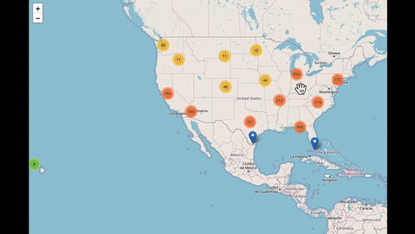
As you can see, we have used clustering here due to having too many points to display all at once. Each blue marker represents the location of an accident. When the user clicks a marker, information about the accident pops up. This information is taken from the MAN_COLLNAME column in the data.
You can download the data by clicking here:
Keep reading with a 7-day free trial
Subscribe to Daily Python Projects to keep reading this post and get 7 days of free access to the full post archives.